Länsirastit, Olari

2014-08-07-olars-qr-splits

After a summer break it's time to start orienteering again.

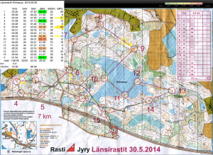
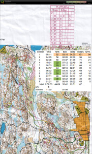
Stable, controlled, and positive run today! Perhaps because rain and thunder had lowered the temperature by five degrees to around +22C so it wasn't as hot as otherwise lately.

  • at #1 should have followed the path for a bit longer, and read the map more carefully to check that the control is actually quite high up on the hill.
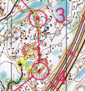
  • #3 perhaps a straighter route in the beginning - and then "punching through" to the big path with speed instead of a tentative J-bend close to the control circle.
  • Found #7 before #6 - should have used better intermediate checkpoints when stepping off the path close to #6
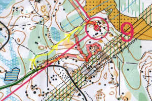
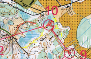
  • To #11 I actually planned to take the norther road but then aimlessly ran down the hill out of #10 and found myself on the straight road south of #10.
Pulse Stretcher - V2

Update: kicad files: 2014-07-23-pulse_stretcher_kicad

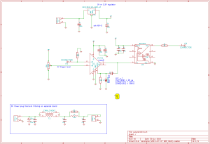
A development on pulse stretcher V1.

This circuit is used to stretch a short 10 ns pulse from a photon-counting module to a 100ns long pulse that can be more easily recorded or time-stamped e.g. with the white rabbit fine-delay FMC.

pulse_stretch_schematic_2014-06-30

The new circuit is the same LT1711-based design as the old one, with an added buffer (BUF602) on the output. This improves output-load handling because the BUF602 can drive both 50 Ohm and 1 MOhm loads.

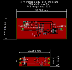
The PCB is made to fit a BNC-BNC enclosure by Pomona.

pulse_stretch_2014-06-30

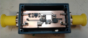
pulse_stretcher_assembled

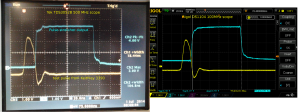
Some testing with an artificial input-pulse from a Keithley 3390 signal-generator..

pulse_stretcher_test_keithley3390

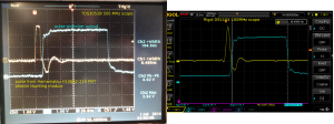
.. and with the actual PMT-pulse. Note how the 100MHz scope produces nice round smooth signals while the 500 MHz Tektronix reveals more of the ugly truth.

pulse_stretcher_test_PMT

Furka Pass and the Rhone Glacier

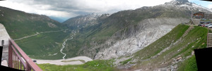
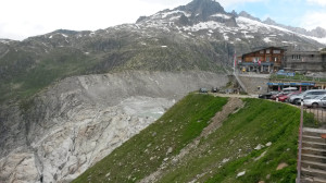
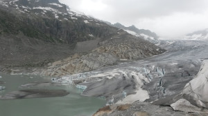
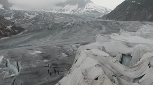
On the way back from EFTF2014 in Neuchatel to Zurich airport we took the scenic route via Grimsel Pass (2165 m) and Furka Pass (2429 m), stopping to look at the ever shrinking Rhone Glacier on the way.

furka_pass_2014-06-28

Google map view of the area: https://goo.gl/maps/DBlwA

rhone_glacier_2014-06-28-shop

rhone_glacier_2014-06-28


rhone_glacier_2014-06-28-ice

See also: a video that compares the footage in the 1964 James Bond movie "Goldfinger" to views in 2011.


Iltarastit Solvalla

Last orienteering run before Jukola - maybe mistakes made now means there are none left in the bag for Jukola?

2014-06-09_qr

K-1-2 nothing special. #2 is best split.
3 more north out of #2 would have been less steep downhill, and would have found the road sooner.
4 crazy mistake although I was inside the control circle on 2 or 3 occasions..
5-6-7-8 nothing special
9 split is slow but GPS-trace follows line OKish. Maybe a little south would have been faster.
10-11-12 OKish, but there is no excuse for not running straight along the 11-12 line.
13 came up from the flat "Punjonsuo" a little more left than had planned, but was easily on the map again.

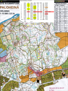
Itärastit Paloheinä

2014-06-07_qr

S-#1 the paths directly north would have been faster
#5-#6 running on the roads, maybe even straight over the hill, would have been faster than pushing through the green area.
#6-#7 bad direction out of #6, straight north would have been OK
#7-#8 most time lost here, and worst split 🙁 Ran along the line until almost inside the control-circle but then circled around loosing 3 minutes. The road north, maybe via the big stone before the control, would have been a safer option?
#11-#12 aiming for the same North-South paths that lead to #1 would maybe have been faster than running along the blue ditch in the green.

Maybe one more orienteering practice before Jukola next weekend!

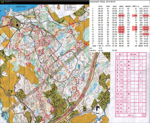
Espoorastit Oittaa

2014-06-03_qr

Four troublesome controls out of 15 in total.

2014-06-03-control4
#4 would have deserved more respect - I just ran roughly out from #3 and started to look for #4 on the wrong hill. Should have used the big stone and the big path as intermediate checkpoints.

2014-06-03-control9
#9 was located quite low and close to the yellow field, so the approach from the powerline and cliffs above is completely wrong. Should have instead taken the small path all the way to the corner of the field and #9 from there.

2014-06-03-control10
Inexplicably lost track of the hills on the way towards #10 and looked for it already on hill nr 2. Then a poorly planned direction out of #10 towards #11 through slow terrain. Staying on the white area of the map would have been much faster.

Länsirastit Kiimasuo

2014-05-29_qr

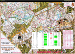
A map where the straightest route was fastest. Many places had cut down trees which were best avoided.

2-3: Drifted too much right, thus my route is unnecessarily long at 137% of the straight-line distance.

5-6: Tried to avoid the slow green area by running on the road/rock, but didn't hit the control and ran past it a bit. Worst split 🙁

8-9: Not much to read/observe on the downslope towards #9. My direction out of #8 is off a bit towards the south and I should have used the big stone and open clearing (circled yellow) as an intermediate checkpoint. Crossed the ditch too much south but found #9 reasonably quickly.

Itärastit Ämmässuo

2014-05-24_qr

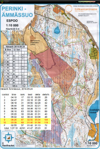
Really hot yesterday - more or less 50% walking from #3 onwards...

#1-#2 OK
Just before #3 should have stayed on the white area - it was slower to cross the yellow open area.
#4-#5 OK
#6 a bit surprised to see the control so soon - did not have a good idea of where I left the road.
#7-#8 OKish (down the hill from #7 perhaps a more direct line over the wet/slow blue area would have been faster)
#9 was going OK all the way into the control-circle, but then went for the wrong group of stones and spent about 3-4 minutes extra here.
#10-F easy but quite tired and dehydrated at this point. Should bring water for 60+ minutes of running in the heat!

Firmaliiga at Pirttimäki on Tuesday is next.