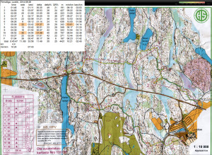
Itärastit, Paloheinä

2014-09-27_ITR_paloheina_qr_splits

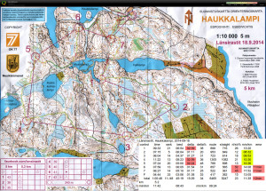
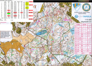
A great big loop around #2 that cost at least +3 minutes 🙁

Then I ran past #5, just didn't look in the right direction at the right moment. Maybe +1 minutes here.

Out of #8, should have avoided the green dashed slow area by rounding it clearly north or south - very slow going until I reached the road. Another minute lost there probably.

Overall an easy course with emphasis on running - as long as clear and good route choices could be made...

Iltarastit, Luukki

2014-09-21_IR_Luukki_qr_splits

Good going on the four first controls, after which I was 6th overall (at best I was 3rd at #3). Quite an uneven performance after that.

A slow north rounding of the hill to #4 - south via the road might have been better.

The short and innocent looking leg to #6 proved fatal. I've run probably within 10-20m of the correct stone but failed to find the control. Worst split and ten placings lost here 🙁

A good long leg to #10 is then followed by overconfidence and a U-loop to #12.

#13-#14-F at the end were fairly straightforward.

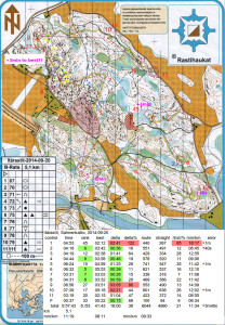
Itärastit, Salmenkallio

2014-09-20_itr_salmenkallio_qr_splits

Worst split (45th) and at least +1min of error right at the start on #1. The first control always deserves a bit of respect - steady and safe is better on #1 than too much speed&risk and a mistake.

#2 OK. Some kind of U-bend on #3 but not too much time lost. Towards #4 I slow down midway for some reason, maybe a bit north and around the blue swamp would have been better.

I almost run past #5 but stop and look around for the flag at the last possible moment.

#6 is the best split (5th) although it did not feel that special. Safely along the path first and then via the bigger cliff that indicates a direction into the control circle. #7 again OK.

#8 and #9 were clearly in the toughest part of the map and I had decided to take them extra carefully.
#8 went well first on the bigger path, then up towards the control on a smaller path, and the last bit through the blue swamp.

#9 did not go well. I take a straight and direct route but that means climbing and descending a lot of cliffs and hills. Over 3 minutes lost to the best runner. It would probably have been much better to go directly northeast out of #8 to the path (yellow arrows), follow the path as far as possible, and then find the control from above (yellow arrow).

#10-#11-F are all along the big path running parallel to the road. When I arrive at the path before #10 I'm unsure if I am left or right of the control? Probably +1min lost reading the map and looking around.
#11 and F require no orienteering, just trail-running.
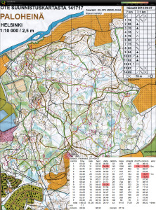
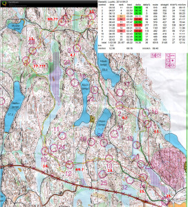
Espoorastit, Suna

2014-09-16_ER_suna_qr_splits

+1min very close to #3 just on the wrong hill before the control.

Not sure why #8 is such a bad split, there must have been a faster direction to approach than the one I took through fallen trees etc. from the path.

+4:30min on #10, more than 6min lost to the best runner, and the worst split by far 🙁 Ran past the northward path and ended up on the big hill close to #11 instead. Not good.

+1min on the last control (#13) where the map wasn't very clear because of a construction site just north of the big road.

Overall about +6:30min of estimated error - mostly OK running otherwise.

KU-rastit, Linnanpelto

2014-09-11_KU_linnanpelto_qr_splits

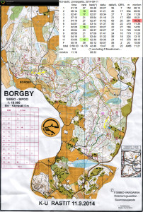
En route to #2 about half-way there was an open cut-down area not marked on the map (??) and then just before the control I turned a bit much to the east.

#3 and #4 went well, and #5 OK but slower. Towards #6 I ran along the grey cliff and after the road failed to directly find the smaller path towards the control.

#7 was surprisingly high up on top of a hill, while the quite long legs to #8 and #9 I managed to complete fairly straight along the control-line. To #9 a route along the road north would have been worth considering.

A route more westward out of #9 to avoid the slow area close to the backyard and lake would probably have been better towards #10.

Itärastit, Spjutsund

2014-09-06_itr_spjutsund_qr_splits

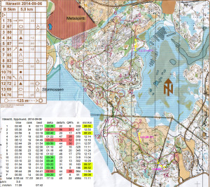
Mostly OK but three mistakes, highlighted in red in the splits and marked with yellow on the map, are worth mentioning:

  • Towards #2 the flag at #13 is visible from far away and lures me in the wrong direction. The wrong control-code is a bit of a surprise but I notice I've arrived at #13 quickly. Worst split and 1:30 or so lost.
  • Towards #5 I drift too much east when a direct line north through the thick vegetation would have been better. Slow walking along the edge of the open (yellow) swamp before climbing the slope to the control.
  • #14 is hard work directly through the open swamp/cut-down yellow area where I stay on course OK. But when crossing the cliff before the control I turn almost 90-degrees left (why??) towards the finish instead of directly over the hill to #14.

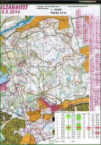
Iltarastit, Paloheinä

2014-09-08_IR_paloheina_qr_splitsThe last Monday orienteering event for this year - as autumn arrives it now gets quite dark after 20:00 or so - and 'Iltarastit' moves to Sundays for five more weeks.

Straightforward orienteering and fast running as usual in paloheinä.

#1 and #2 OK. Then to #3 a J-bend (maybe +30 s) instead of using the line between the white and light-green forest as a guide directly to the control.
Reasonable going towards #4 but quite tentative and lots of looking at the map close to the control. #5-#6-#7 OK.
The biggest mistake came on #8 which should have been easy. Slightly the wrong direction south through a bit of forest and towards the bend in the big road. However I arrive at the wrong bend and there's also someone else there who makes the same mistake. +2 minutes probably.
#9 OK along the road, and #10 also OK. On the way to #11 I read the map along the wrong bend in the small river and the big road comes as a surprise, +30 s at least for stopping and map reading here.
To #12 and the Finish I take a direct route, but avoiding some of the climbing would probably have been faster.

Overall 14./52 which is OK.

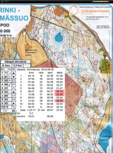
Itärastit, Ämmässuo

2014-08-30_ITR_ammassuo_qrSlow and safe without major mistakes.

Unnecessary bends/loops a bit before #2 and just before #4. Clearly the wrong direction out of #5, and then quite confusing out of #6 where the yellow area on the map was actually thick forest!? Up the hill to #7 a little too early and some searching for the control on top of the hill. A very slow route to #9 with almost 9 min lost 🙁

Firmaliiga 6/2014, Luukki

2014-08-26_FL_luukki_qr_splits

Last firmaliiga event this year.

This course often had a clear path/road as one route choice. Decent running with an overall 11./80 placing.


Best splits are #4 and #6 where I was 6./80 - not bad!

From #3 I didn't even consider a direct route, just quickly back to the big path. Then up onto the slope, with a small cliff and stone providing verification of my exact location. Over the grey open cliff and a bit further I see the flag. Not much thinking, stopping, or walking - just execution.

#5-#6 was the second longest leg and possibly the most challenging? Out of #5 just after the first blue swamp I made a conscious decision to go south - not directly over the hill along the control-line, and instead ran along a path with the big stone and cliffs as mid-way checkpoints. Then down onto the second blue swamp, and following other runners up onto the stony slope towards #6 - enough other people there so no searching for the flag required. Again mostly just executing a good plan with very little standing around or slow map reading. Good.

The worst splits are #7  and #10. Out of #6 I had a clear plan to go a bit north, down the hill north of the steep cliff, find the smaller path and use that to get to the bigger path. Execution of this plan however was poor and instead I drifted towards the road and climbed two hills for no use. Close to #10 I stepped off the path too soon, stood around wondering for a while, and then followed others to the control - it didn't feel that bad but  1:58 lost to the best runner is a lot and only 30th in the splits...