Category: Sport
Wednesday Thirteen
Sunday twentytwo
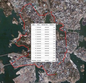
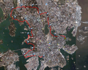
A nice way to get some variation into the long runs is to take the bus/metro somewhere far and run back home. Google says it's only about 13 km by car to Vuosaari, but if you follow the coast closely it's much longer.
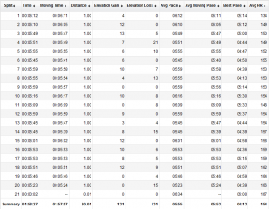
km 2-4: Lots and lots of new houses in Aurinkolahti (Helsinki's own Santa Cruz) before a dive into a green area at km 5-6 (roughly resembling Helsinki central park). Over the vuosaari bridge at 7-8, and into Marjaniemi, an older housing-area around km 8-10. At km 12 you can look at the rich people who are envious of the even richer people, because they have a nicer RIB at the pier just down from their (multi?)million-euro villa. More lots and lots of new houses at "Eastend", a newly built area at km 14-15. The houses are built to look like (large) cottages in the archipelago with a grey weather-beaten-wood look to the outside. However closer inspection reveals it's not wood, just a paneled grey-painted wall. I wonder if admiral Cronstedt would approve? The Iraqi embassy at the 90-degree bend between km 16 and 17 looks as if nothing ever happened, with a well groomed lawn and flowers at the front. Gloves on for the windy kulosaari-bridge at km 18 which offers a nice view into the city center - you can easily count 5-6 churches another half dozen landmarks from here. The view would be even nicer without the architectural concrete-wonders of merihaka at km 20. Just after km 21 the restaurant on tervasaarihas put up a cheesy advert featuring santa-claus and santas-little-helpers. Since the pace was a slow 6:30/km-ish, I decided to quit at 2 hours 20 minutes, or 22 km.
Sunday sixteen
Friday ten
Sunday 8k
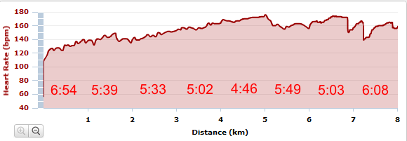
One week after the marathon all but some minor soreness in the ankles is gone. Legs feel good again and tried an accelerating first 5k today.
There's a 10k event in two weeks, but I wonder how crowded it will be with walking and zigzagging for the first 1-3k? Under 50 minutes on the 10k would be nice.
Helsinki City Marathon
Been there, done that, have the medal, have the T-shirt!
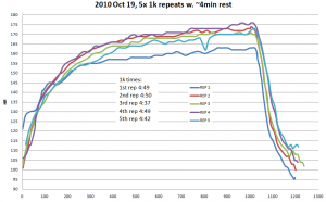
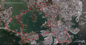
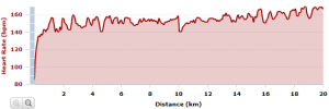
It was hot and it was humid. I also had a strange ache in both my knees and my ankles which towards the end made each step forward painful. I was doing OKish through 30km and a bit further, but after that the walks at the drinking stations became longer, and I walked the uphills towards the end. Finished in 4h 42min. The breakup into 20k/10k/5k times shows how I got more tired towards the end:
The first 20k took 2h1min and the second 2h 23min.
The first 10k took 59min, 2nd 62min, 3rd 67min, and 4th 76min.
5k times: 29min, 30min, 30min, 31min, 33min, 34min, 36min, 40min
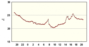
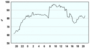
Temp(left) and humidity(right) data from FMI for around 15-19 o'clock shows T=23-25 C and RH=70-80% at least.
In colder weather, with a bit more training, and without the knee-ache, the next goal must be to break 4h!
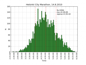
Update: the finishing times are distributed like this:
This histogram was produced by scraping the results website with one python script and the plotting the results with another.
Download the scripts hcm_scrape.tar (works on Ubuntu 10.04LTS) hcm_scrape.tar
A whole series of histograms are on picasa: http://picasaweb.google.com/anders.e.e.wallin/HCM2010Statistics#
Jakob halvmaraton 1:50:37
This week the plan was to do the last 20+ km run before the Helsinki marathon, which is in three weeks on 14 Aug 2010. But since I was in the region and there was a race, I did the Jakob half-marathon instead. Results and info at http://jakob-marathon.net/
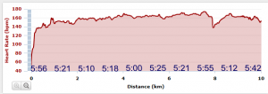
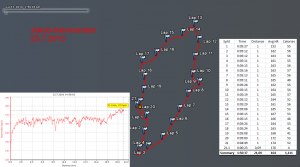
This is a small event with 4-500 runners, so less walking, pushing, and passing in the beginning than at HCR or Forssa. I didn't really set a time-goal, just ran in the beginning at a pace that felt right, which today was around 5:11 to 5:20/km. There were four drinking stations at a little after 4, 8, 12, and 16 km which show up as slightly slower kilometers in the data. Towards the end a few faster kilometers would have maybe allowed a sub 1:50 time.
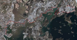
The grey background shows roughly the level of detail which google earth/maps provides in this part of the country...
"He de maraton e noo flaka beta!"
By popular demand, an openstreetmap rendering. Fiddled around with the openstreetmap.org website but could not get it to display my GPS trace on top of the map. When searching for "gps" ubuntu suggests tangoGPS, but that doesn't reder gpx-traces either. Then downloaded and installed Merkaartor, which does show gpx-traces after clicking around for a bit to learn how it works. At a zoom level which shows the whole route Merkaartor doesn't show individual streets, so I zoomed in a bit, exported two bitmaps (top/bottom) from Merkaartor, and manually stitched them together in GIMP.
