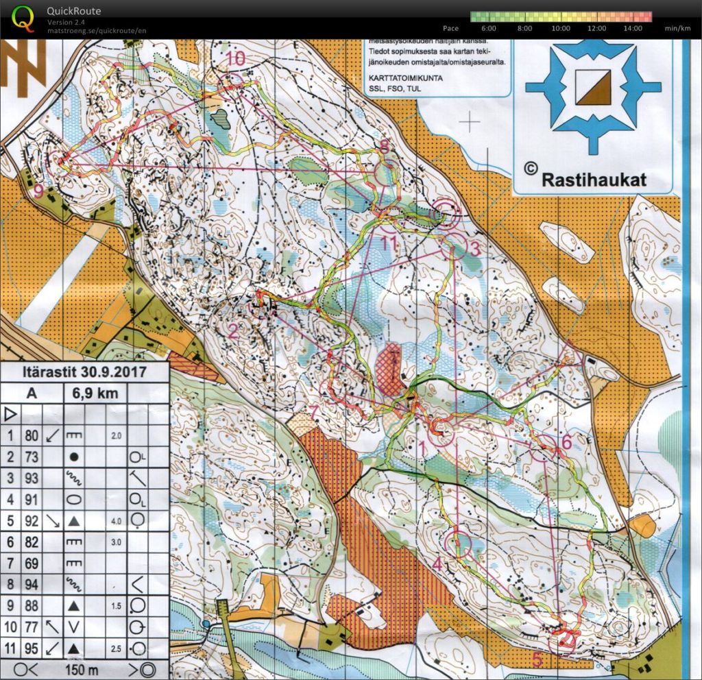
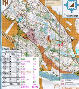
Zigzag around salmenkallio. Easy pace, but 8-9-10 looks pretty crooked anyway. Maybe +13 C.
Tag: salmenkallio
Itärastit Salmenkallio
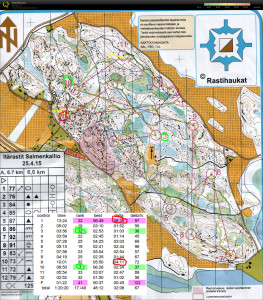
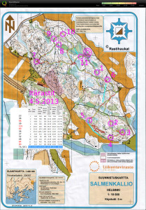
About +11 to +13C with a cold-ish wind. After the first start at 11:00 they were out of maps by 12:00 - thus this less than ideal hand-drawn map. Quite good from the start towards the south, but then a few mistakes, J-curves and loops towards the end. I'm happy this course didn't have controls in the top left corner which has way too many map symbols... Around 65 min with maybe 10 min of mistakes.
Itärastit Salmenkallio
Itärastit Salmenkallio
Itärastit Salmenkallio
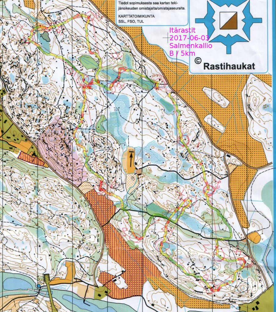
Quite tentatively towards #1, catching the big cliff (yellow arrow) more by luck than skill and from there the control.
On #6 and #7 I tried to avoid the slow green areas but in hindsight my route is too zigzaggy. #9 ran out of steam a bit. #10 is the best split as I crossed the big path as planned and found the control via the big stone and swamp.
#11 is an identification mistake where I mistook a stone lower down for a one upper on the hillside (yellow arrow), resulting in a loop back to the control.
Itärastit, Salmenkallio
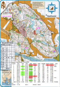
Worst split (45th) and at least +1min of error right at the start on #1. The first control always deserves a bit of respect - steady and safe is better on #1 than too much speed&risk and a mistake.
#2 OK. Some kind of U-bend on #3 but not too much time lost. Towards #4 I slow down midway for some reason, maybe a bit north and around the blue swamp would have been better.
I almost run past #5 but stop and look around for the flag at the last possible moment.
#6 is the best split (5th) although it did not feel that special. Safely along the path first and then via the bigger cliff that indicates a direction into the control circle. #7 again OK.
#8 and #9 were clearly in the toughest part of the map and I had decided to take them extra carefully.
#8 went well first on the bigger path, then up towards the control on a smaller path, and the last bit through the blue swamp.
#9 did not go well. I take a straight and direct route but that means climbing and descending a lot of cliffs and hills. Over 3 minutes lost to the best runner. It would probably have been much better to go directly northeast out of #8 to the path (yellow arrows), follow the path as far as possible, and then find the control from above (yellow arrow).
#10-#11-F are all along the big path running parallel to the road. When I arrive at the path before #10 I'm unsure if I am left or right of the control? Probably +1min lost reading the map and looking around.
#11 and F require no orienteering, just trail-running.
Itärastit Salmenkallio
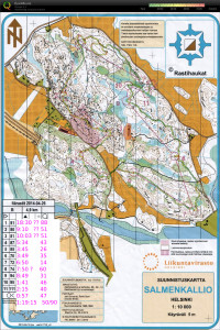
#1 lots of problems with mistaking one path for the other as well as not knowing which big stone on the map is which in reality
#2 looping close to the control circle - should have a good secure plan all the way to the control
#3 no real route plan and as a result a completely crazy path up&down a big hill. the paths to the left would have been much better probably.
#4, #5, #6, and #7 went OK with #7 being the best split, mostly running on compass-bearing on top of the hill - checking progress form stones/shapes on the map.
#8 drifted too much to the right and going down the steep hill was slow. a bit of hesitation close to the control.
#9, #10, #11 OKish.
Itärastit, Salmenkallio
Itärastit, Salmenkallio
- #2 could have taken a more direct route close to the control
- #6 ran very very close to the control - then decided to search right for 200m when the control would have been to the left about 5m.
- #7 should have clearly chosen either the path or the road - now an in-between choice that wasn't so great.
Itärastit, Salmenkallio
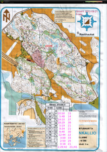
4.5.2013 Salmenkallio. Ugh - many mistakes (five out of twelve legs) - and they were out of maps so had to use a hand-drawn map.
#3 circling around as I was looking for the control on top of a ridge or at a saddle, when in fact it was much lower down. Wrong interpretation of height contours..
#5 BIG problems. It should have been easy to run along the path and look for the right cliff features on the right and find the control 50m from the path. I managed to climb the hill much too soon and circle around on top of it. Dead last in the split-times! ![]()
#6 veering off compass course to the right, which resulted in unnecessary distance. Blue line shows a better direction.
#11 somehow I was afraid of the green area and decided to run around it, but made a much bigger loop than necessary. Should have run right through(blue line) the green thick area!
